
Saturday,
|
|
Saturday,
|
|
Saturday,
|
|
Saturday,
|
|
Saturday,
|
|
Saturday,
|
|
Saturday,
|
|
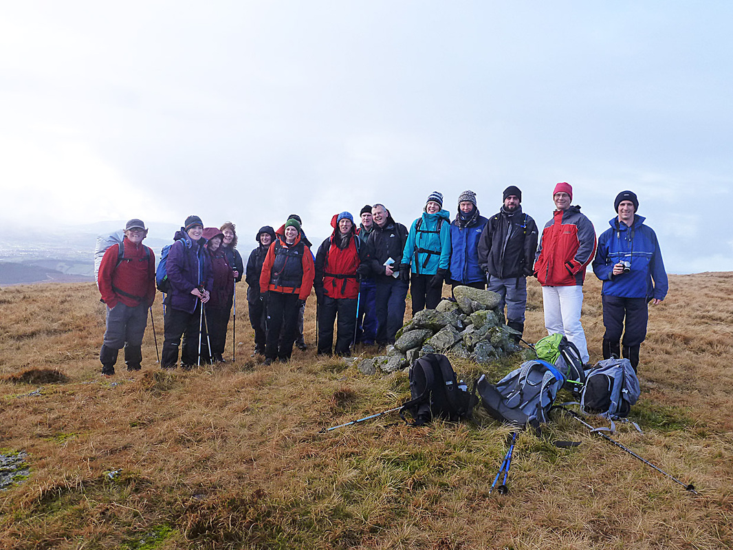
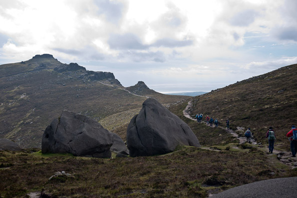
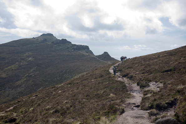
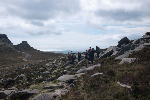
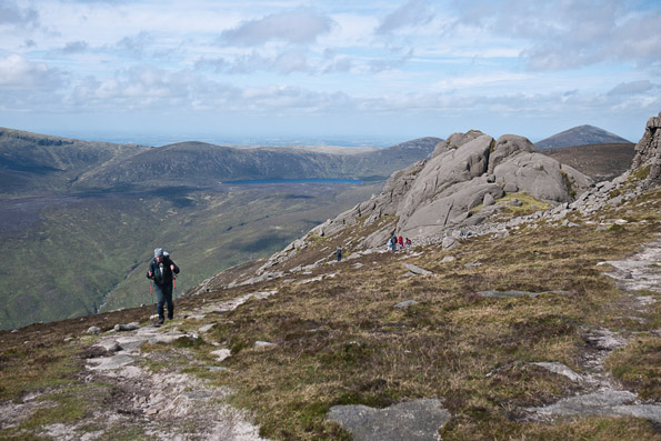
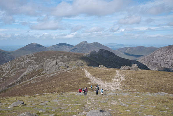
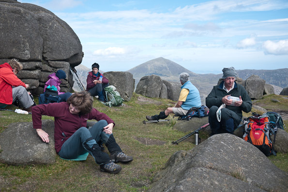
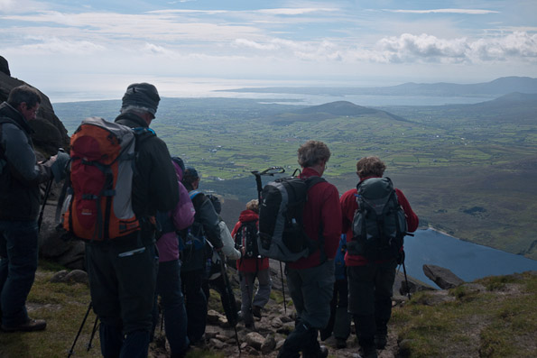
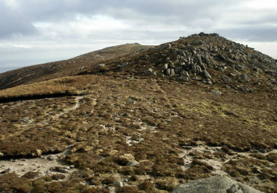
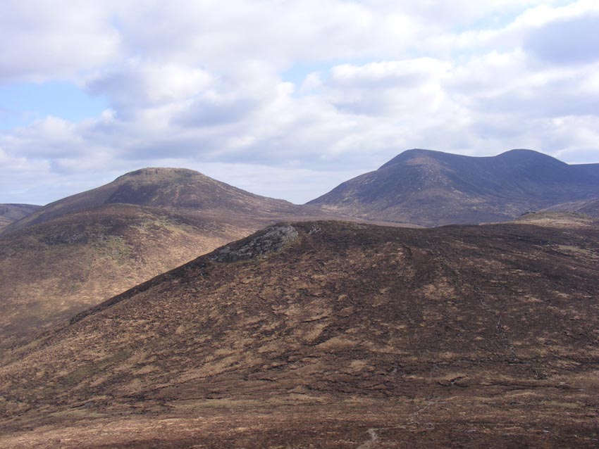
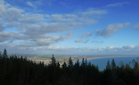
Saturday, 6th October 2012 There were around a dozen walker on the walk on Saturday. It was a day where the clear skies from lower altitudes soon dominated the hilltops as well and we had beautiful views all around the high Mournes and beyond.
Stephen led us up from Ott lay-by and then along the wall to the tops of Slieve Loughshannagh, Meelbeg and Meelmore - where we stopped for lunch. We then went back into the Happy Valley and over the snout of Meelbeg to the edge of Fofanny Dam. Several people were taking advantage of the good weather and setting up camp there for the evening. We were soon back at our cars and enjoying a farewell cuppa in Meelmore Lodge. Thanks Stephen. A great day. |
|
Saturday,
|
|
Saturday, 1st September 2012
Slieve Binnian, Mournes

Saturday,
|
|
Saturday,
|
|
Killarney,
|
|
Saturday, 14th July 2012Rathlin Island
15 persons appeared at Ballycastle Harbour for the trip. We had an exciting and rough crossing to Rathlin but with Blue skies. We then took the bus to the bird sanctuary at the west lighthouse. Puffins, Razor Bills and other birds in abundance. We then walked along the back cliffs with beautiful views to Islay, Mailn, the Mul of Kintyre and even Jura. We had time to laze at Churchtown before a calmer sea journey home. We were very lucky with the weather -we even managed some sunbathing David |
|
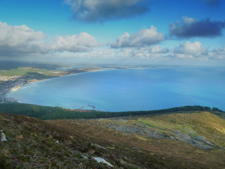
Saturday, 23rd June 2012Chimney Rock
Torrential rain on Friday night left me poring over the map looking at wet weather option (tollymore forest anyone?) but Saturday dawned dry though overcast and 10 spartan showed up to Bloody Bridge car park. The forecast warned us that the weather would deteriorate so we selected a route up the bloody river track, onto Slievenagarragh and hence to Chimney Rock itself where, despite occasional showers, we were rewarded with views over the Annalong valley and to menacing clouds in the distance. We descended with equal promptness - managing a very respectable 10km in our 4 hour hike - past the youth groups jumping into the river and back to the cars long before the proper rain hit. Gerard |
|
Saturday, 16th June 2012Tullymore and Slievenabrock
When Friday night’s weather forecast put an end to plans to go to Rathlin Island David Flynn had to frantically ring round to alert those booked. As an alternative he proposed a walk in the Mournes, but given the heavy clouds and grim forecast it probably wasn’t too surprising that I was the only one to turn up at the Trassey car park to join David and Rachel. Apart that is from a large group of people who were doing a long charity walk and had probably thought that a day in mid summer was just the day to do it. Our original intention was just to do a loop of Tullymore forest. It was raining when we started, a reasonably gentle rain that turned to light drizzle and then stopped completely as we walked through the woods, and it was quite pleasant. So much so that when we came to the wall and the stile below Slievenabrock it seemed obvious to give it a go and do a bit of actual hillwalking. Clever weather. As those of you who have been there know the slope up to Slievenabrock is very pretty, has great views, is quite steep, and has absolutely no protection whatsoever. We were about half way up when it started to rain again, much heavier than before. It was a pretty grim struggle, and a very wet one, but we got to the top eventually, when naturally the rain stopped. |
|
Saturday, 9th June 2012North Coast - Giants Causeway
|
|
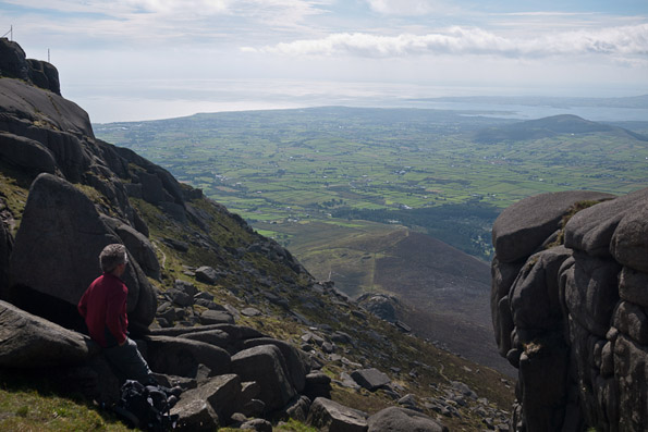
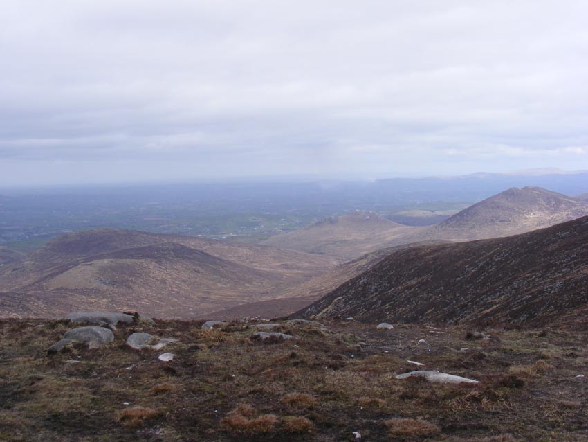
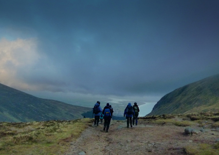
Saturday, 2nd June 2012Mournes
A beautiful Saturday morning in Newcastle town. Sun block applied as 11 Spartans boarded the 9.30am rambler bus bound for Ott car park. Upon arrival, Elaine and Nigel joined the group as we followed the track towards Doan. The air was cool as the sun tried to burn off the morning cloud. On reaching the summit of Doan (594m), I noticed Nigel coughing heavily; maybe lack of oxygen or climbing too fast I heard someone say. Once we got him settled with a cuppa and a biscuit, his condition stabilised. Evaluating the risk to the rest of the expedition team, I advised Nigel to return back to base camp for a further medical examination and to buy a bottle of covonia. ( Nigel just had a chesty cough that day ) The panoramic views where magnificent from the central summit of the Mournes. Our descent from Doan was steep as we headed to cross the Ben Crom river and down to the Dam where we happened upon Barbara, Angela, Helen and Marion. We had lunch on the south side of Lamagan |
|
Saturday, 26th May 2012Mournes
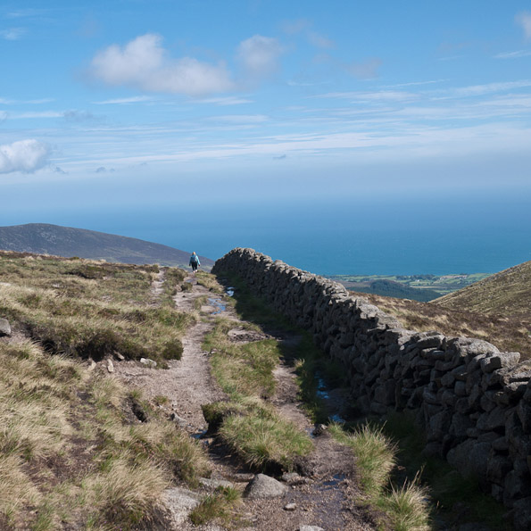
For once the forecasters had thrown caution to the wind, and we were promised "wall to wall sunshine" for Saturday. And for once they were right. So it was great that Marie Doran had volunteered to fill a gap in the programme and even better that she had devised such a novel route, well off the beaten track for the most part. Our rendezvous was Donard Car Park, at the rear of O'Hare's bar and once mustered there, we shared cars for the transfer to Bloody Bridge. With several Spartans in shorts, copious amounts of suncream were applied and we sallied forth up the track to the Mourne wall. The sky was blue, the sun was strong overhead, and there was, mercifully, a slight following breeze. But how envious we were of the children who were having a dip in one of the rockpools on the river. Under their dad's supervision, they were having a whale of a time jumping into the pool. It was, of course, another excuse for a brief halt to get our breath back and top up on water as we made our ascent. The views got better and better as we gained height and the visibility was remarkably clear as we gazed back down to the coast. We crossed the recently installed footbridge and after noting the remains of the old mineral cable way on our left, we took a left for Chimney Rock Mountain. Soon we were making the final ascent to the rocky summit, which mercifully was our main lunchstop. Sheltered from the breeze, the heat was beautiful and we were able to lie back and imagine we were on some Mediterranean beach, except that the scenery was miles better. All too soon Marie gave notice that we would be on the move in five minutes and we reluctantly packed up. After a brief foray to the highest point, and a chance to savour the panoramic view across all seven sevens, we descended to the wall, crossing the relatively dry Bog of Donard before heading along the Brandy Pad. In the |
|
Saturday, 12th May 2012Binevenagh
Twelve Spartans met at the Lions Gate at Downhill from where Dorothy led us in convoy to the start of today's walk - St Aidan's Church and Holy Well just below the slopes of Binevenagh. St Aidan's has quite a history that stretches back to the early Christian Church. http://www.discovernorthernireland.com/St-Aidans-Church-and-Holy-Well-Limavady-P3344 We followed the path through the trees - with bluebells and wild garlic amongst the variety of plants here and we were soon walking underneath the impressive basalt buttresses of Binevenagh itself. Our walk took us under these buttresses to the western end of the cliffs where a gentle climb brought us to the top of Binevenagh and a great view in wonderful light. We could see the panorama of north Derry fields stretching out to the Magilligan sandhills and strand. Lough Foyle sweeping round from it's narrow entry at Magilligan Point. Further to the west we could see the hills of Inishowen and beyond the distinct shape of Muckish. |
|
May Bank Holiday 2012 Portnoo, Donegal
The group of 19 congregated at our three self-catering houses in the small hamlet of Naran beside Portnoo. We mostly arrived in the evening and went to the local bar for a pint and a bite served from the adjoining “restaurant”.
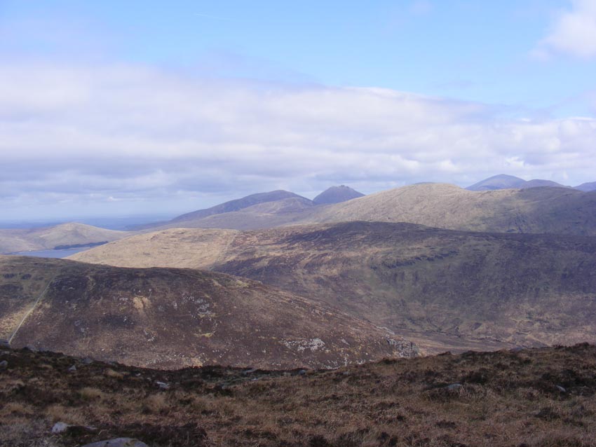
On Saturday morning David and Rachel had arranged for us to meet their friends, James and Livvie who are members of The North West Mountaineering Club and familiar with the area. Our rendezvous was the Old School House above Crolack farm - the starting off point for the walk known as The Blue Stack Five. The walk is aptly described in Tony Whilde & Patrick Simms’ Walking Guide for West & North Ireland - A 10 mile walk with an ascent of 2500 ft and a walking time of 6 to 7 hours. The Blue Stack Five are the hills – Glascarns Hill; Croughbann; BlueStack; Lavagh More; Lavagh Beg. For those who completed the walk, the book mentions the … “scant remains of a Sunderland aircraft which crashed in January 1944. “… “Parts of the wreckage, which lay around a stream, were removed in 1990 to a local history museum in Glenties. Although the weather on Saturday had a gun metal feel to the light, it was clear enough and dry. With a little suggestion of snow and a temperature that changed from quite cool to reasonably warm – although that may have been due to the exertion on my part. We had a break on Croaghbann and shortly after we could see Lough Eske far below. The views were actually very good. The whole of Donegal seemed visible – with Slieve Snaght to the north and the Glover skyline beyond (Errigle/Muckish etc); Slieve League and Slieve Toohey to the west and Donegal Town and Donegal Bay to the south and the hills of North Mayo. We could see Cuilcagh on the Fermanagh/Cavan border and Lower Lough Erne. |
|
Saturday, 5th May 2012Six Spartans walked from Pigeon Rock to Slieve Mageogh, Eagle Mt., Slieve Moughanmore and back to Pigeon Rock carpark. Good weather all the way. Attached are some photos of the walk.
Thanks for the walk Simon. |
|
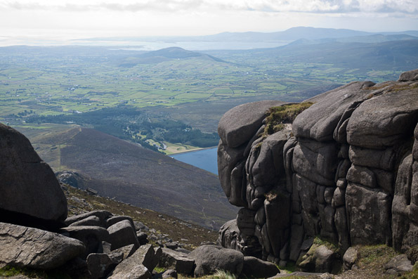
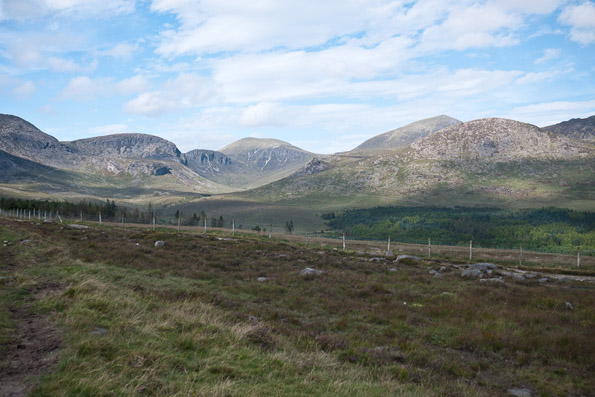
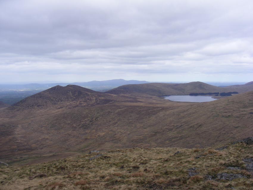
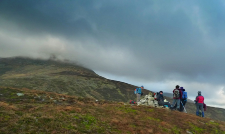
Saturday, 28th April 2012Mournes
There were twelve in the group that met at the busy Trassey Car Park on the Trassey Road. From there to the Hare's Gap, we were accompanied by those participating in at least two events that day. So a reasonably crowded walk to the Hare's Gap itself. From there to the Shelter Stone area at the top of Ben Crom Reservoir we saw very few other people and enjoyed the gradual descent to the dam for lunch - noting just how low the water level was for the time of year. After lunch we followed the Kilkeel River back up to the Brandy Pad - passing the actual Shelter Stone on the way!! We reached the Mourne Wall on the top of Slieve Corragh and followed it along to the top of Slievenaglogh. After crossing the wall we descended to Lukes Mountain and finally back through the blossoming gorse on the lower slopes before making it back to the carpark. An enjoyable walk. Nigel |
|
Saturday, 21st April 2012Glenshane.
The forecast for the day was showers (some heavy at times and slow moving) with bright intervals. Eleven of the group met at the specified place, beside Glenshane Forest. The rain was there to meet us too!! Alan had us all well organised with printed copies of the route for the walk and a bag of Haribo Starmix for each of us and off we set across Altrasna Bridge and into the Glenshane Forest. We followed the path through the forest with views of the river, moss covered trees and a startled heron until we came to The Priest's Chair - a Mass Rock nestled amongst the trees, just off the path and marked on Alan's map as "First Break"!! After resting and snacking as the rain slackened for a time, we climbed a slippery bank out off the forest and onto the side of our first summit, Bohilbreaga (478m). The cloud had lifted and broken sufficiently for us to see out to Lough Neagh and to Slemish and the Antrim Hills in the east and with Slieve Gallian to our south and the typical Sperrins valley below with Moneyneany and Draperstown in the mid-distance and Banagher Forest creeping up the sides of Mullaghmore, our next high-point and also our lunch stop. As we sat at lunch and looked out over the view, the weather took another one of it's many active (and wet) spells of the day. So we hastily packed away our lunches and headed for the |
|
Saturday, 14th April 2012Slievemartin.
From the upper carpark in Kilbroney forest, 17 Spartans walked to the top of Slievemartin and from there to Knockshee. Lunch was enjoyed on the slopes of Knockshee with stunning views of Carlingford Lough. We returned to the carpark via Rostrevor Forest covering a total of 9 miles (14km). Apart from a few isolated hailstones after lunch, we enjoyed excellent weather throughout. James and Audrey McKeown |

|
Saturday, 31st March 2012
Mournes.

St. Patrick's Weekend
|
|
Saturday
|
|
Saturday
|
|
Saturday
|
|
Saturday
|
|
Saturday
|
|
